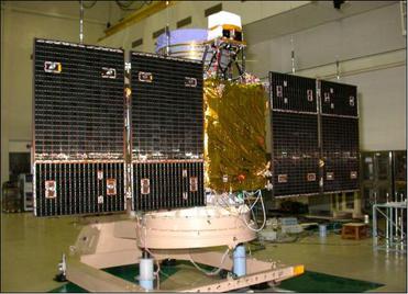
CARTOSAT-2F
Mission information
- Name
- CARTOSAT-2F
- Satellite ID
- CPRM-2766-1516-4979-3667
- NORAD ID
- 43111
- Website
- https://www.isro.gov.in/Spacecraft/cartosat-2-series-satellite-2
- Country of Origin
-
India
Status
Operational
Satellite is in orbit and operational
Image
Mission timeline
- Launch Date
- 2018-01-12T03:59:00+00:00
Description
Cartosat-2F is an Earth observation satellite developed by the Indian Space Research Organisation (ISRO), it is the eight of the Cartosat 2 series of satellites used for the collection of high-resolution, large-scale imagery for use in urban planning, infrastructure development, utilities planning, and traffic management.
SatNOGS Links
Beacon
- Type
- Transmitter
- Downlink Mode
- CW
- Downlink Frequency
- 2245687000
S-band telemetry (800000)
- Type
- Transmitter
- Service
- Earth Exploration
- Downlink Mode
- BPSK
- Downlink Frequency
- 2242000000
- Unconfirmed
- Yes
Most Recent Observers (last 24h)
No observations recorded for CARTOSAT-2F in the last 24h
Data Frames Decoded - 30 Days
There is no decoded data for this satellite in the last 30
days.
No Decoders Found
Help us develop a decoder, you can find instructions at this wiki link
Orbital Elements
Latest Two-Line Element (TLE)
- TLE Source
- Space-Track.org
- TLE Updated
- 2024-04-29 07:39:17 UTC
- TLE Set
-
1 43111U 18004A   24120.17003843  .00007396  00000-0  35444-3 0  9996
2 43111  97.4347 180.4315 0002310 167.2675 192.8618 15.19208907349056
No Satellite Suggestions Found