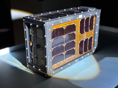
HyTI
Mission information
- Name
- HyTI
- Alternate Names
- Hyperspectral Thermal Imager
- Satellite ID
- ZUAV-9462-1904-5734-0704
- Temporary NORAD ID
- 98899
- Followed NORAD ID
- 59561
- Website
- https://www.hsfl.hawaii.edu/missions/hyti/
- Country of Origin
-
United States of America
Status
Operational
Satellite is in orbit and operational
Image
Mission timeline
- Launch Date
- 2024-03-21T20:54:00+00:00
- Deploy Date
- 2024-04-18T11:36:00+00:00
Description
HyTI is a 6U CubeSat demonstration mission that will enable the next generation of high spatial, spectral, and temporal resolution thermal infrared (TIR) imagery acquisition from low Earth orbit. A future constellation of 25-30 HyTI satellites could monitor Earth’s volcanoes for signs of impending eruptions and map soil moisture for crop management at lower cost than a single, conventional satellite.
SatNOGS Links
Most Recent Observers (last 24h)
No observations recorded for HyTI in the last 24h
Data Frames Decoded - 30 Days
There is no decoded data for this satellite in the last 30
days.
No Decoders Found
Help us develop a decoder, you can find instructions at this wiki link
Orbital Elements
Latest Two-Line Element (TLE)
- TLE Source
- Celestrak (active)
- TLE Updated
- 2024-05-15 17:39:57 UTC
- TLE Set
-
1 59561U 98067WL  24136.24834152  .00044635  00000+0  69865-3 0  9999
2 59561  51.6365 118.4140 0002893 124.9036 235.2227 15.53286681  4170
No Satellite Suggestions Found