CARTOSAT-2
Mission information
- Name
- CARTOSAT-2
- Alternate Names
- IRS-P7
- Satellite ID
- CASG-2405-5488-8993-2476
- NORAD ID
- 29710
- Country of Origin
-
India
Status
Decayed
Satellite has re-entered
Image
Mission timeline
- Launch Date
- 2007-01-10T00:00:00+00:00
- Decay Date
- 2024-02-14T00:00:00+00:00
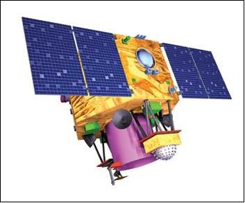
Description
CartoSat 2A is an Indian photo-imaging craft that was launched by a PSLV-C7 rocket from Sriharikota at 03:57 UT on 10 January 2007. The 680 kg craft will provide panchromatic images at one-meter resolution, to aid civil planning, and other cartographic needs.
SatNOGS Links
Beacon
- Type
- Transmitter
- Downlink Mode
- CW
- Downlink Frequency
- 2245.687 MHz
- Downlink Drifted
- 2245.678 MHz
Most Recent Observers (last 24h)
No observations recorded for CARTOSAT-2 in the last 24h
Data Frames Decoded - 30 Days
There is no decoded data for this satellite in the last 30
days.
No Decoders Found
Help us develop a decoder, you can find instructions at this wiki link