CARTOSAT-2B
Mission information
- Name
- CARTOSAT-2B
- Satellite ID
- DOVD-6076-5561-0818-8216
- NORAD ID
- 36795
Status
Operational
Satellite is in orbit and operational
Image
Description
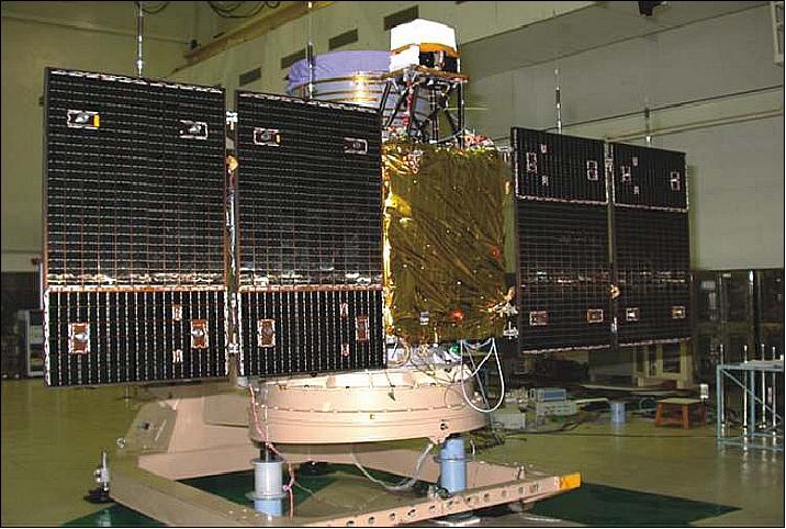
Cartosat 2B, an Indian Earth observation satellite, was launched on 12 July 2010 at 03:52 UT from Sriharikota. The 694 kg satellite was launched by a Polar Satellite Launch Vehicle. The satellite carries a panchromatic, high spatial resolution, stereoscopic vision camera. The satellite's black and white camera has a resolution of 0.8 m and will observe Earth land and ocean surfaces from orbit. The imagery will have applications in resource mapping, urban planning, transportation studies, water monitoring, and crop inventories.
SatNOGS Links
Beacon
- Type
- Transmitter
- Downlink Mode
- CW
- Downlink Frequency
- 2245.687 MHz
- Downlink Drifted
- 2245.682 MHz
Most Recent Observers (last 24h)
No observations recorded for CARTOSAT-2B in the last 24h
Data Frames Decoded - 30 Days
There is no decoded data for this satellite in the last 30
days.
No Decoders Found
Help us develop a decoder, you can find instructions at this wiki link
Orbital Elements
Warning: There is at least one newer non-redestributable TLE set.
Latest Two-Line Element (TLE)
- TLE Source
- Celestrak (SatNOGS)
- TLE Updated
- 2025-07-09 01:02:36 UTC
- TLE Set
-
1 36795U 10035A   25189.86054970  .00000490  00000+0  73513-4 0  9998
2 36795  97.8074 243.7427 0010873 219.6904 140.3512 14.78738557809194