- Name
- GRITSS
- Alternate Names
- 2026-156BQ
- Satellite ID
- KHHV-1921-7769-5036-6297
- NORAD ID
- 69931
- Country of Origin
-
Netherlands

Satellite is in orbit
- Launch Date
- 2026-07-07T00:00:00+00:00
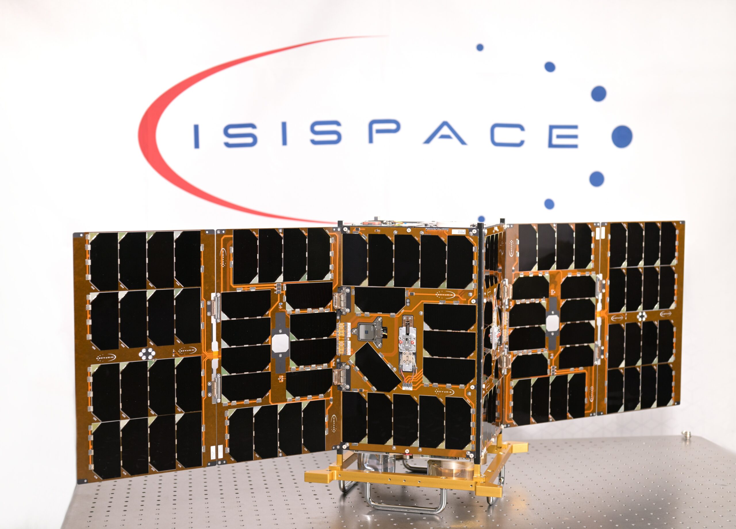
GRITSS, Geodetic Reference Instrument Transponder for Small Satellites. Developed on behalf of NASA and the University of Massachusetts Lowell (UML), the mission will demonstrate innovative geodetic technologies designed to improve the accuracy of the International Terrestrial Reference Frame (ITRF), a fundamental reference system that supports Earth observation, navigation, and climate science. ISISPACE was responsible for the design, manufacturing, integration and launch preparation of the 12UXL spacecraft, while also providing its flight-proven QuadPack deployer and launch integration services. The mission combines ISISPACE’s small satellite expertise with the scientific leadership of NASA and UML to enable a technology demonstration that could benefit future Earth observation missions.
- Type
- Transmitter
- Downlink Mode
- BPSK
- Downlink Frequency
- 401250000.0
- Baud
- 1200
| Observer | Latest Data |
|---|---|
| PE0SAT-12-JO21mr | 2026-11-17 10:24:37 UTC |
| PE0SAT-JO21mr | 2026-11-17 10:24:37 UTC |
| SOBE01-JN89hf | 2026-11-17 08:52:06 UTC |
| PE2BZ-403-JO22ca | 2026-11-17 08:47:02 UTC |
- TLE Source
- Space-Track.org
- TLE Updated
- 2026-11-17 09:15:28 UTC
- TLE Set
-
1 69931U 26156BQ  26320.95519162  .00003019  00000-0  29737-3 0  9993
2 69931  97.7410 219.2574 0011102  74.3752 285.8691 14.92749369 19789
Satellite Suggestion History
| Date of submission | Date of review | User | Reviewer | Verdict | Details |
|---|---|---|---|---|---|
| 2026-11-08 23:31 | 2026-11-09 07:05 | sv2hwm | fredy | Approved | |
| 2026-10-03 19:04 | 2026-10-07 18:55 | pe2bz | fredy | Approved |