TROPICS PATHFINDER
Mission information
- Name
- TROPICS PATHFINDER
- Alternate Names
- TROPICS-01
- Satellite ID
- BVWK-5543-8812-7194-6506
- NORAD ID
- 48901
- Website
- https://www.eoportal.org/satellite-missions/tropics
- Country of Origin
-
United States of America
Status
Decayed
Satellite has re-entered
Image
Mission timeline
- Launch Date
- 2021-06-30T00:00:00+00:00
- Decay Date
- 2024-07-26T00:00:00+00:00
Description
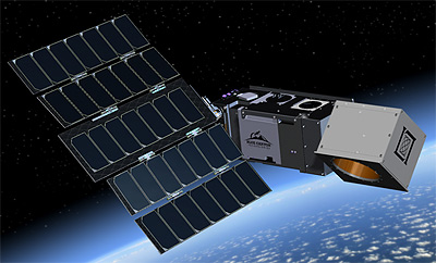
TROPICS (Time-Resolved Observations of Precipitation structure and storm Intensity with a Constellation of Smallsats) is a constellation of seven identical 3U CubeSats provide sounding with 30-minute median revisit rate.
2 of the TROPICS failed launch.
They will measure environmental and inner-core conditions for tropical cyclones.
SatNOGS Links
S-band telemetry
- Type
- Transmitter
- Downlink Mode
- FM
- Downlink Frequency
- 2252250000
Most Recent Observers (last 24h)
No observations recorded for TROPICS PATHFINDER in the last 24h
Data Frames Decoded - 30 Days
There is no decoded data for this satellite in the last 30
days.
No Decoders Found
Help us develop a decoder, you can find instructions at this wiki link