- Name
- Qilu 4
- Alternate Names
- OBJECT B
- Satellite ID
- IIJF-3991-0816-8884-5091
- NORAD ID
- 48249
- Country of Origin
-
China
Satellite has re-entered

- Launch Date
- 2021-04-27T00:00:00+00:00
- Decay Date
- 2023-07-10T00:00:00+00:00
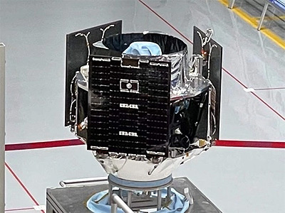
Qilu 4 is an optical earth observation satellite which mainly serves remote sensing industry users mainly in Shandong Province. The Qilu 4 satellite is an optical remote sensing satellite with a high-resolution panchromatic camera mounted on the satellite. It is mainly used to obtain the needs of various industries such as Shandong Province's land, urban construction planning, agriculture, forestry, energy, disaster prevention and mitigation, etc. High-resolution satellite remote sensing images. It is a sister satellite to Foshan 1, with both satellites capable to operate jointly for stereo imaging.
- Type
- Transmitter
- Downlink Mode
- FM
- Downlink Frequency
- 401.680 MHz
No observations recorded for Qilu 4 in the last 24h