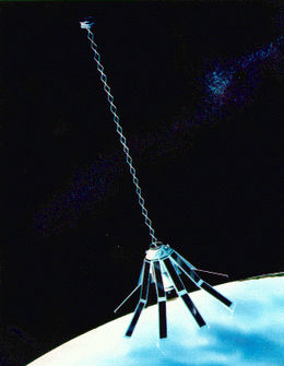
GEOSAT
Mission information
- Name
- GEOSAT
- Satellite ID
- QHZO-5950-9827-8337-2626
- NORAD ID
- 15595
- Country of Origin
-
United States of America
Status
Operational
Satellite is in orbit and operational
Image
Mission timeline
- Launch Date
- 1985-03-13T00:00:00+00:00
- Deploy Date
- 1985-03-13T00:00:00+00:00
Description
Geosat is a US Navy satellite designed to measure sea surface heights to within 5 cm.
SatNOGS Links
CW
- Type
- Transmitter
- Downlink Mode
- CW
- Downlink Frequency
- 400032000
Mode V - CW Beacon
- Type
- Transmitter
- Downlink Mode
- CW
- Downlink Frequency
- 150012500
Most Recent Observers (last 24h)
| Observer | Latest Data |
|---|---|
| DIYSATELLITE-GF05ug | 2026-07-26 19:26:43 UTC |
| LW2DYB-GF11br | 2026-07-26 19:26:15 UTC |
| Plyachka-KN12rl | 2026-07-26 03:33:24 UTC |
| SA2KNG Omni UHF/VHF-KP03cu | 2026-07-26 03:25:58 UTC |
Data Frames Decoded - 30 Days
There is no decoded data for this satellite in the last 30
days.
No Decoders Found
Help us develop a decoder, you can find instructions at this wiki link
Orbital Elements
Latest Two-Line Element (TLE)
- TLE Source
- Space-Track.org
- TLE Updated
- 2026-07-26 19:35:16 UTC
- TLE Set
-
1 15595U 85021A   26207.60764081  .00000181  00000-0  10045-3 0  9993
2 15595 108.0411 163.4772 0002020 293.2448  66.8481 14.39983973168440